THE CITY OF GRAN DAR
City Layout
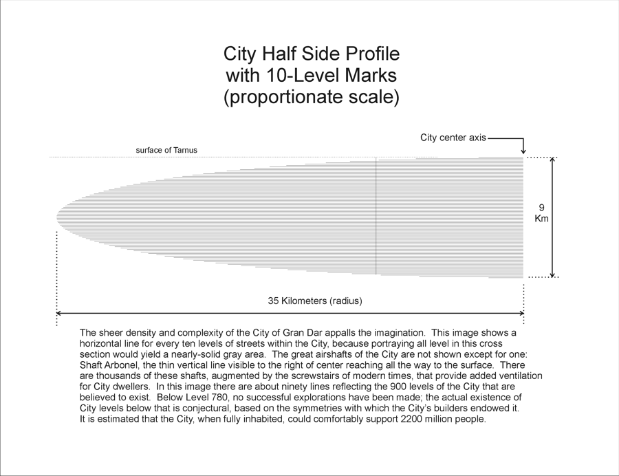
The City‘s sheer size makes visualization very hard. Here is a profile of half of the City, cut through its central vertical axis, showing 10-level lines to illustrate the scope of the whole setting.
CITY SIDE PROFILE
 |
Looking down at the very top of the City, laid open to see the layout of radial and ringway streets, we can appreciate the architecture and some of the scale involved. These images only show the top three levels of radial and ringway streets. Note that as the streets fan outward from the City axis, the number of radials doubles whenever the length of a ringway block exceeds a certain value.
CITY TOP LEVELS
| Level | City Top Level Street Plans |
| Streets of Level 1 | 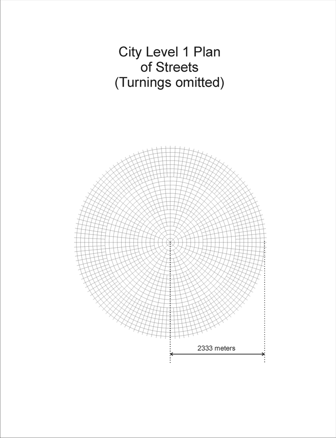 |
| Streets of Level 2 | 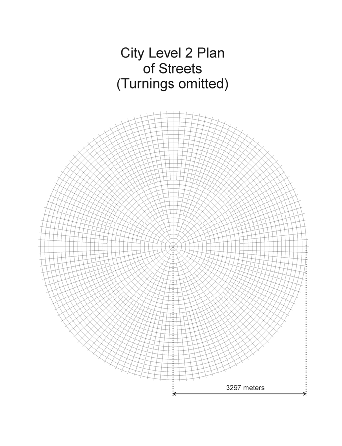 |
| Streets of Level 3 | 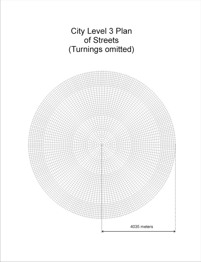 |
| Some details of Level 1 | 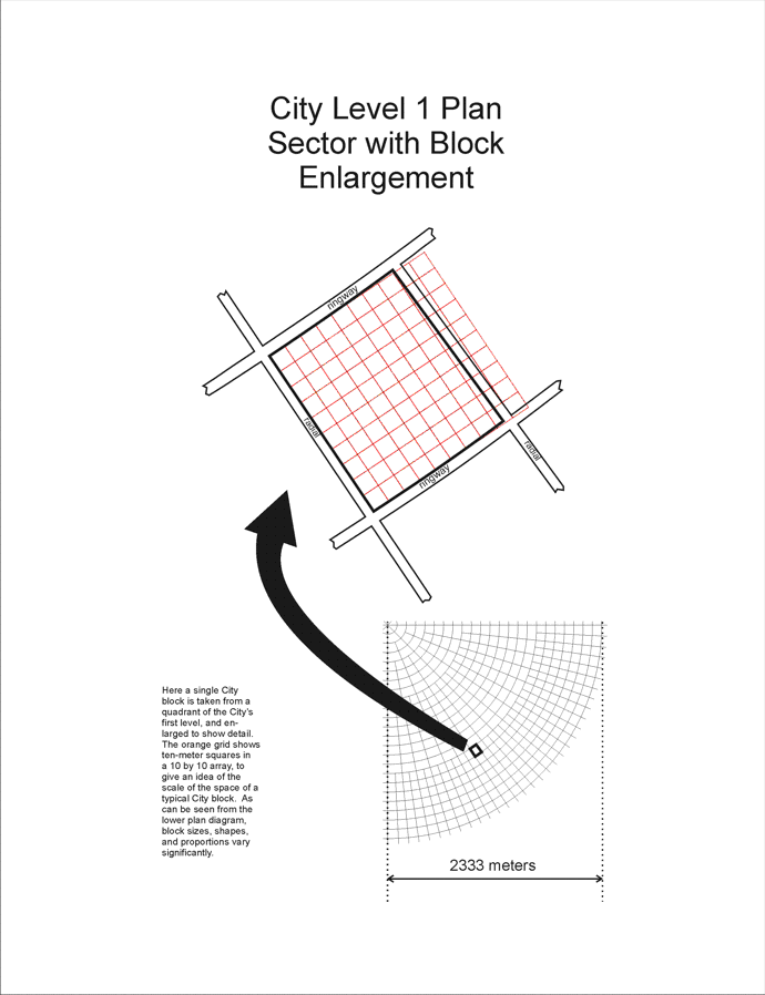 |
Looking down at the top of the City from a greater distance, laid open to see the diameters of the City‘s fifty top levels, we see the sheer size of just this small part of the metropolis. For comparison with the scale of the top three levels, one image here shows the entire top level with its street pattern.
CITY TOP 50 LEVELS
| Image Description | City Top Level Diameters |
| Diameters of the top 50 levels | 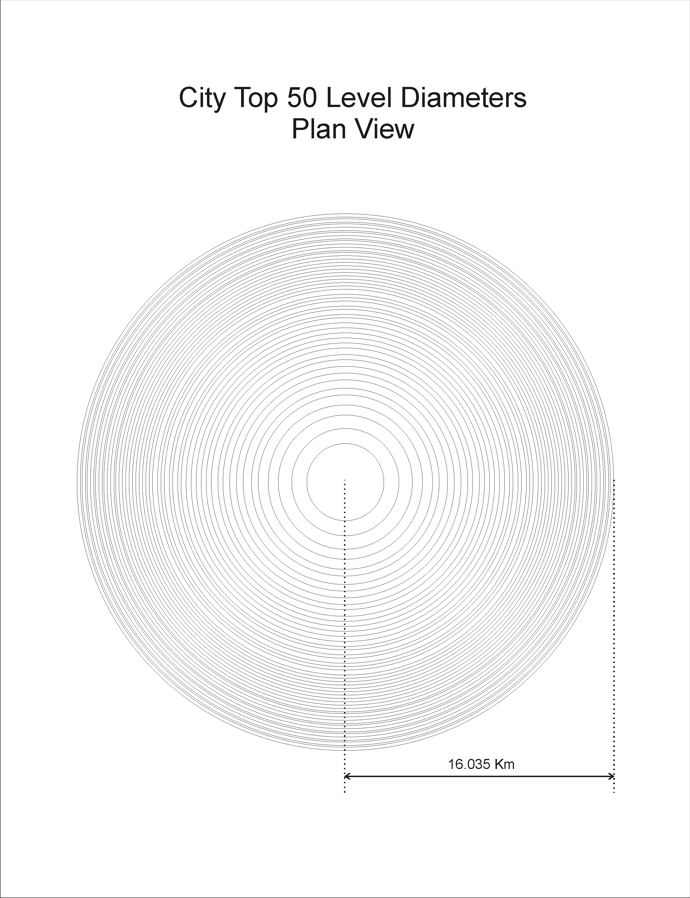 |
| Diameters of the top 50 levels with all of Level 1 detail showing | 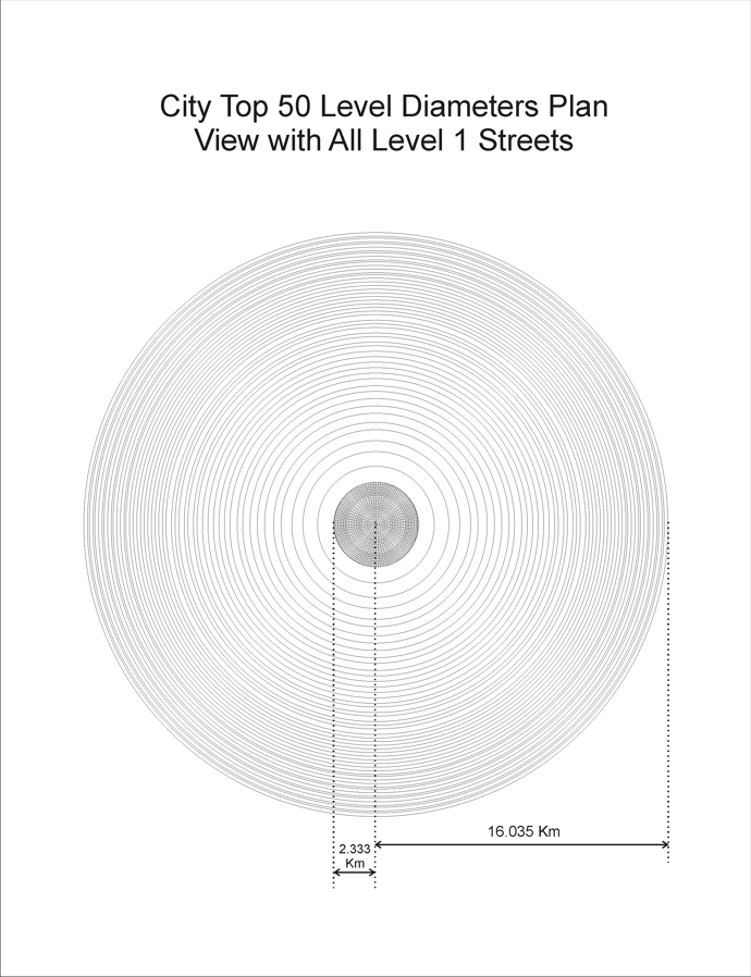 |
| Oblique view of the top 50 levels | 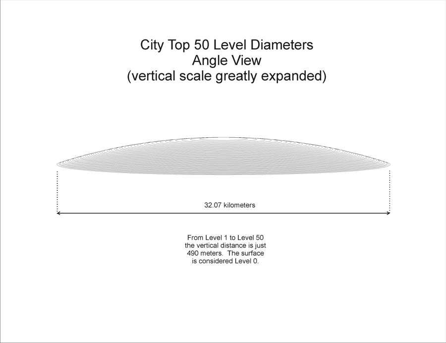 |
City Closeups
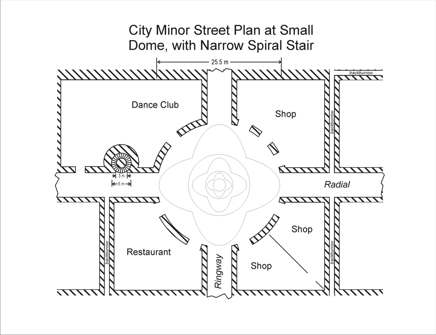
We move in closer to see an example of a City crossing of radial and ringway, where a dome is carved out, and shops and other establishments do business.
CITY LOCAL STREET PLAN
 |
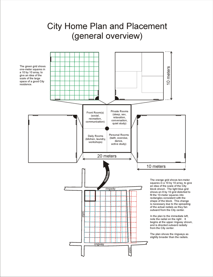
City neighborhoods follow similar plans, with spacious homes and easy access.
CITY HOME PLAN
 |
City Streets
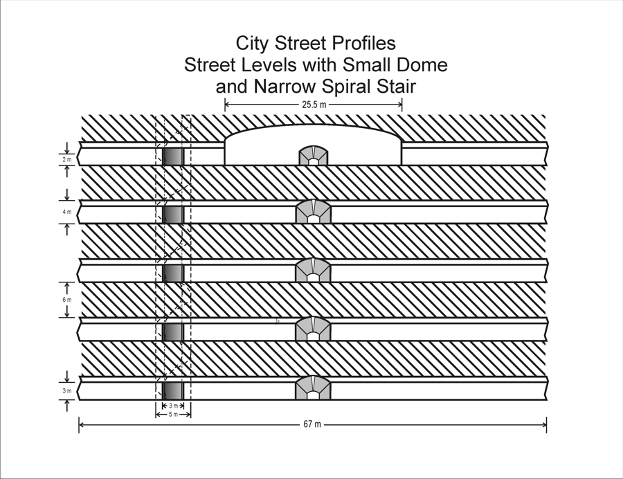
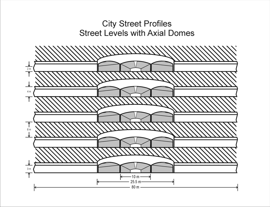
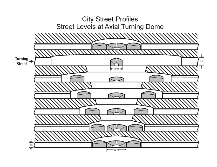
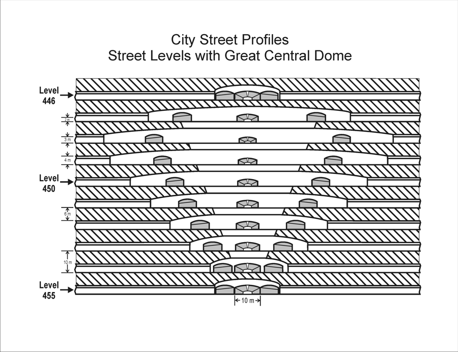
Streets and domes define City social life.
CITY STREET PROFILES
| Dome and Stair | Axial Domes | Axial Turning Domes | Great Central Dome |
 |
 |
 |
 |
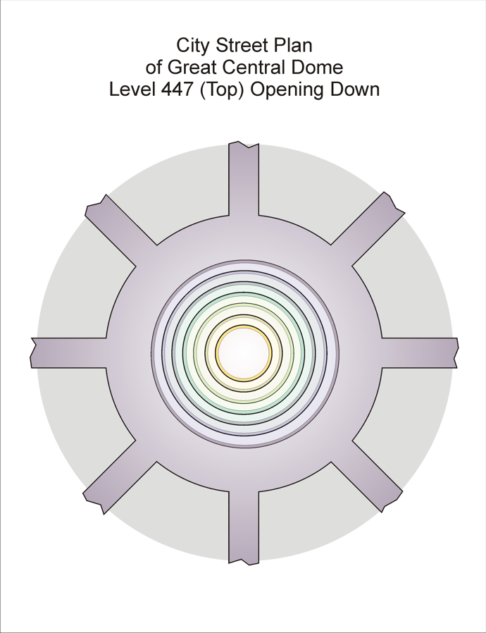
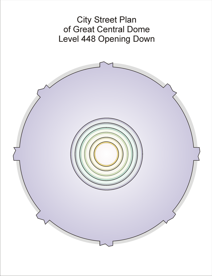
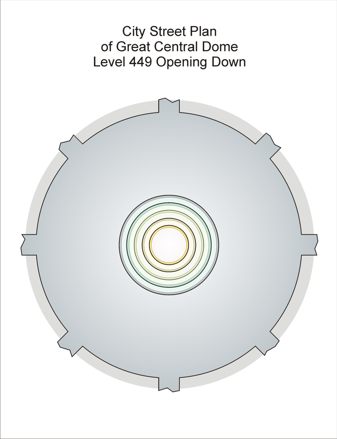
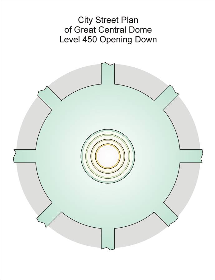
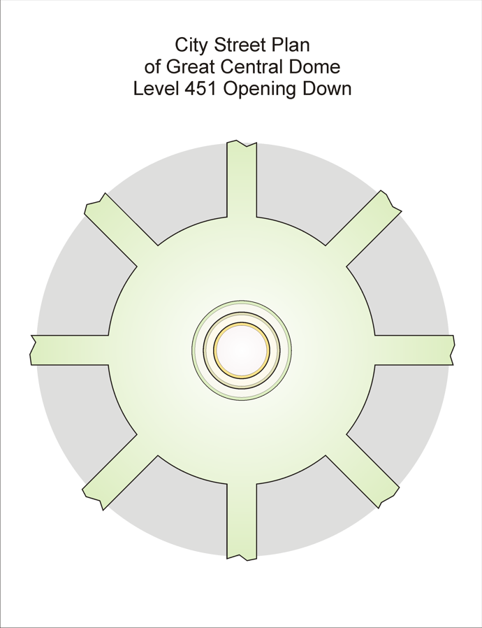
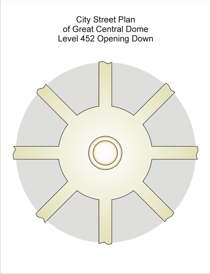
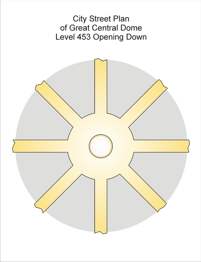
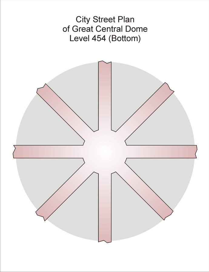
The Great Central Dome is a beautiful, multilayered, open structure at the very center of the metropolis. Here are its layers, one by one, looking straight down through the opening they share.
THE GREAT CENTRAL DOME
| Central Dome Top Views | Central Dome Top Views | Central Dome Top Views | Central Dome Top Views |
 |
 |
 |
 |
 |
 |
 |
 |
Turnings must be visualized from a distant perspective to appreciate their beauty and intricate structure.
CITY TURNING DIAGRAMS
| City Turning Roads | Notes |
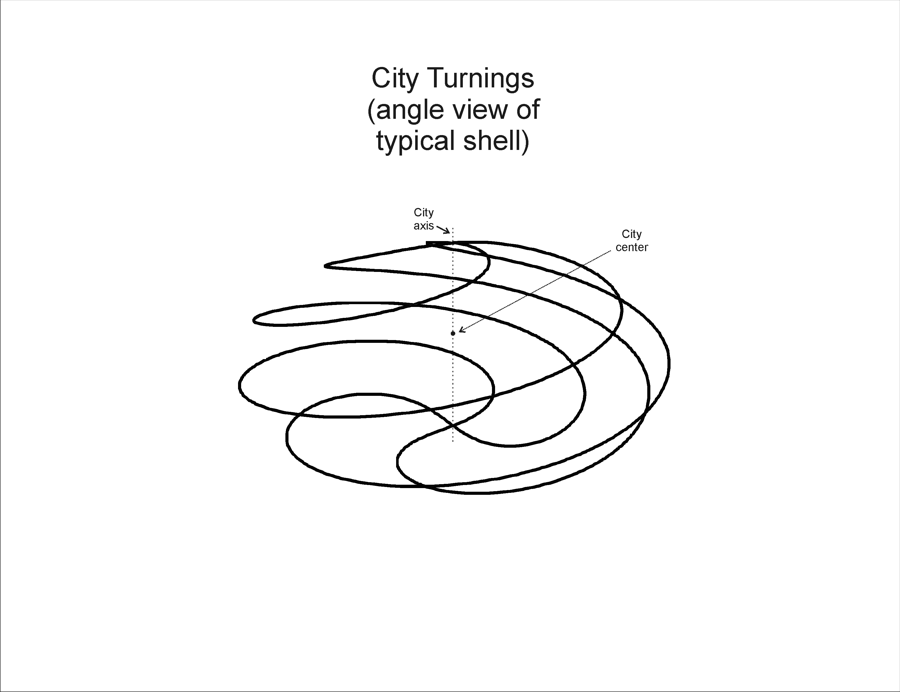 |
A side perspective view of one of the four sets of four turning roads each, spiraling around an ellipsoidal contour of the City. |
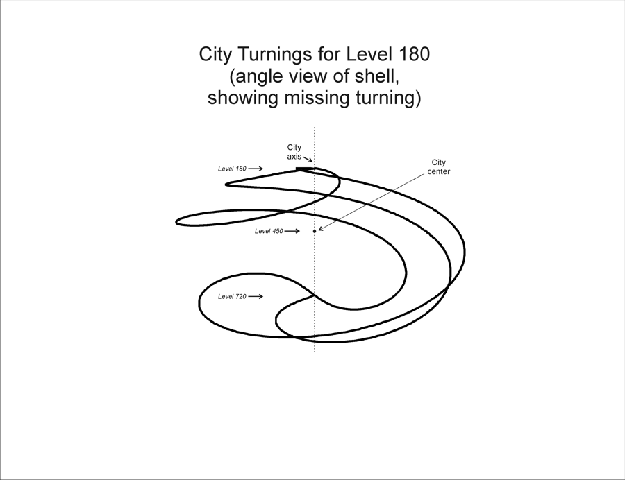 |
A side perspective view of the one seemingly-incomplete set of three turning roads, originating at Level 180. |
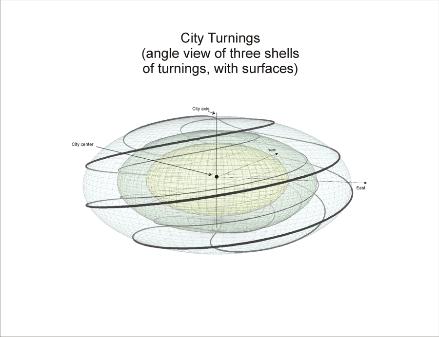 |
A side perspective view of three of the four concentric sets of turning roads. |
Gran Dar, called the City simply because of its unique size and character, is the hub of all governance, knowledge, and organization on Tarnus. Its structure and appearance still carry mysteries predating the Colonization. Here are a few diagrams of its layout and physical features.
CITY AIRSHAFT DIAGRAM
 2x3.png) |
CITY AIRSHAFT PLAN DIAGRAM
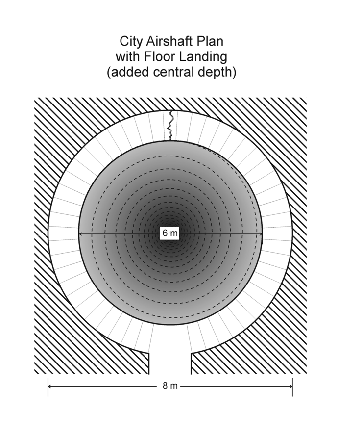 |
Stairs
CITY STAIR DIAGRAM
 2x3.png) |
This article will be updated and extended as needed.